The Navigation Computer: Solving for Heading and Ground Speed
The most common requirement in navigation and planning is finding the heading to fly. In planning a trip, you will join up your turning points on a map using a ruler and then measure the track of the straight line. This means that you already know your track. What you need to know is the heading to fly, because the wind will probably cause some drift. It is the reverse of the problem we solved earlier.
So let us see how you use the Navigation Computer, given track, to find the heading to fly.
Take this example:
You are in an aircraft with a planned TAS of 146 knots. The forecast W/V is 315/20.
You need to fly a track of 040°(T).
What is the heading to fly, and what will your ground speed be?
Start off by plotting the wind on in the usual way. It is 315/20
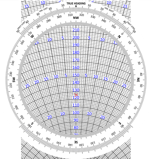
Now put the TAS (146 knots) under the blue circle and rotate the central disc round to put the desired track (040°) against the 12 o’clock index.
This will show a drift of 8 degrees starboard, like this:
What this is telling you is that if you fly a HEADING of 040°, you will experience 8° starboard drift and fly a TRACK of 048°.
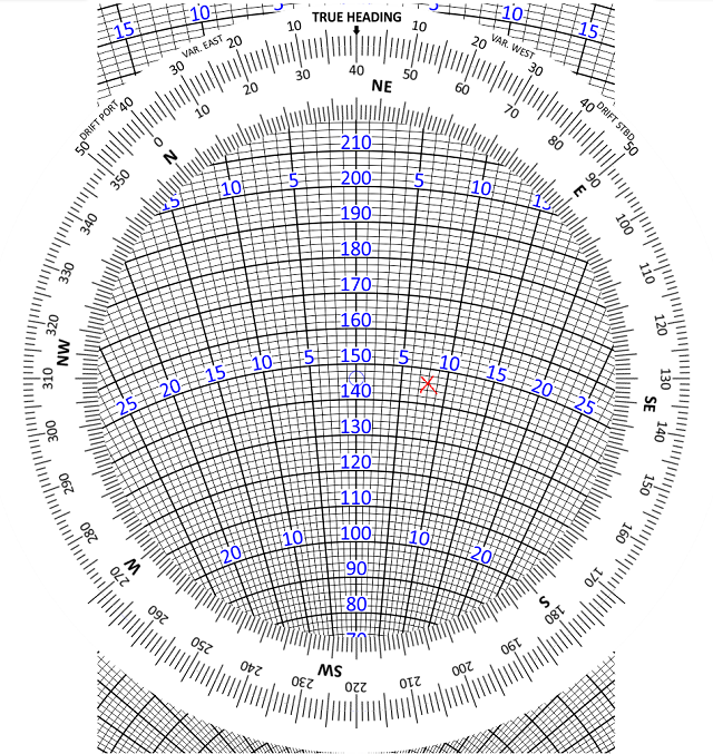
You want to fly a TRACK of 040°. So what heading do you need?
If a heading of 040° gives you 8° starboard drift, try aiming off 8° to the left and seeing if the drift changes. Try a heading of 032°.
Rotate the disc to put 032° under the 12 o’clock index and check to see whether the drift has changed. Sometimes it does, sometimes it does not. It depends on the geometry of your particular triangle of velocities.
The drift is still 8° starboard. This means that we have solved the problem. With a heading of 032° and 8° starboard drift, we get a track of 040° - which is what we wanted.
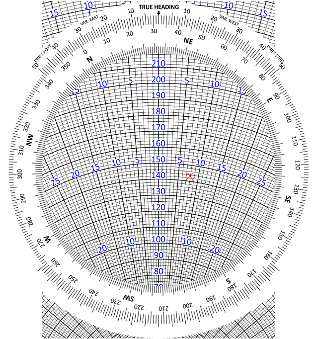
Now there is just one final thing to do - establish what the ground speed will be.
You can now see that the ground speed will be 143 knots.
Next: Changing Drift
© 2022 terms of use privacy policy
