The Navigation Computer: Calculation of True Altitude from Indicated Altitude and Temperature
The altimeter is calibrated against an ISA atmosphere, so a particular set of values of temperature is assumed. If the temperatures on the day at the various levels of the atmosphere are different from ISA, the indicated value will not correspond to true altitude. At higher levels this is not a problem since all aircraft experience the same temperature error in the same part of the atmosphere and can still maintain vertical separation from each other. However, when close to the ground it is necessary to know true altitude in order to maintain terrain clearance.
If the other altimeter corrections have been made (position error, instrument error) and the correct QNH is set, the indicated error differs from the true altitude by temperature error. This can be corrected either by use of a formula or with the Navigation Computer.
The formula is as follows:
True Altitude = Indicated Altitude + ( ISA Deviation × Indicated Altitude / 273 )
However, if you treat 1/273 as 1/250, then you can write it as 4/1000. This is the basis of the “4% rule” used in Meteorology.
True Altitude = Indicated Altitude + (ISA Deviation × 4/1000 × Indicated Altitude)
Example: Indicated Altitude is 20000 feet. SAT is -35°C. What is True Altitude?
ISA at FL200 is -25°C, so our SAT of -35°C is ISA -10°C.
Substituting into the above equation:
True Altitude = 20000 + ( - 10 × 4/1000 × 20000)
True Altitude = 20000 + ( - 800 ) = 19200 feet
This corresponds to what you would expect. The column of air is 10°C colder than ISA. This means that it is denser air. Therefore, the pressure reduces more rapidly than ISA as you climb through the atmosphere because there are fewer feet to a hectopascal with denser air. So you will pass through the required number of hectopascals needed to give an indication of 20000 feet in less than 20000 feet True Altitude.
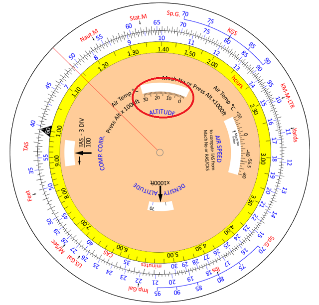
However, it is rather easier with the Navigation Computer. We carry out the correction using the ALTITUDE window.
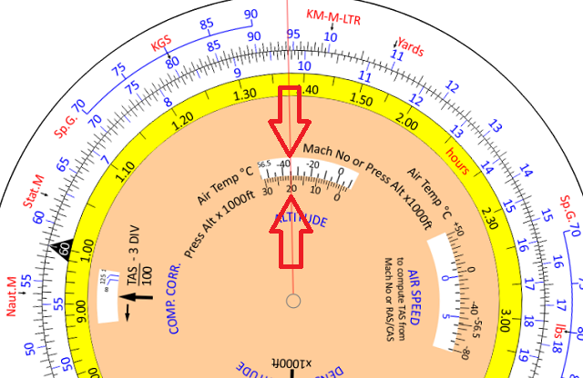
Using the same example, in the ALTITUDE window, align 20000 feet with the SAT of -35°C. By doing this, you have set up a relationship between the inner and the outer scales.
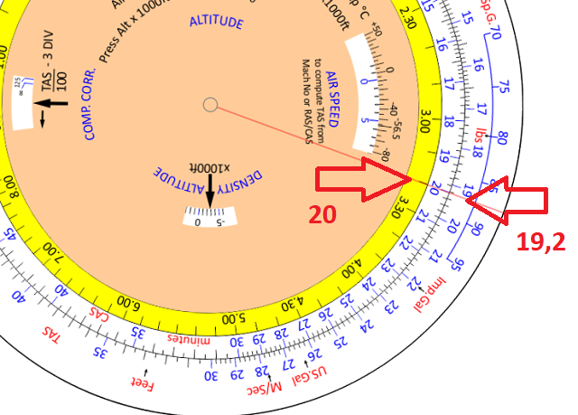
The outer scale now shows the True Altitude corresponding to the Indicated Altitude on the inner scale.
Against 20000 feet (Indicated Altitude) on the inner scale, read 19200 feet (True Altitude) on the outer scale.
In any question which requires you to correct Indicated Altitude to True Altitude, the Navigation
Computer should always give an accurate answer and there is no need to use the formula. In addition, you can use the ambient temperature directly and there is no need to calculate ISA deviation. True Altitude questions should, therefore, always be solved by use of the Navigation Computer.
Next: Calculation of Density Altitude from Pressure Altitude and Temperature
© 2022 terms of use privacy policy
